Category:Rail transport maps of Merseyside
Jump to navigation
Jump to search
Media in category "Rail transport maps of Merseyside"
The following 13 files are in this category, out of 13 total.
-
 Around Liverpool railway map 1921.svg 1,226 × 1,334; 155 KB
-
 Borderlands line Map.png 1,600 × 2,992; 2.57 MB
-
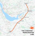 Chester-Manchester line.png 1,707 × 1,747; 2.31 MB
-
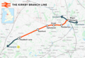 Kirkby branch line.png 1,488 × 1,019; 1.09 MB
-
 Liverpool-1911.jpg 400 × 650; 93 KB
-
 Liverpool–Manchester lines.png 2,501 × 1,575; 3.39 MB
-
 Liverpool–Wigan line.png 1,914 × 1,396; 1.99 MB
-
 Manchester–Southport line.png 8,177 × 5,270; 17.71 MB
-
 Map of rail routes between Liverpool and Manchester in 1960.svg 702 × 318; 1.33 MB
-
 Mersey Tram Catchment.svg 950 × 648; 8.48 MB
-
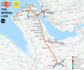
.png/103px-Northern_line_(Merseyrail).png) Northern line (Merseyrail).png 2,353 × 2,730; 2.96 MB
Northern line (Merseyrail).png 2,353 × 2,730; 2.96 MB
-
 Railway Ormskirk Skelm St Helens 1911 edited-4.jpg 1,057 × 1,290; 932 KB
-
 Wirral line.png 2,721 × 2,260; 3.64 MB


.png)

